Basic Information
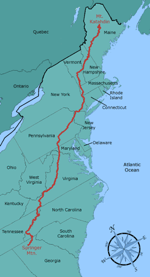
The Appalachian National Scenic Trail, generally known as the Appalachian Trail or simply The A.T., is a 2195.1-mile (as of 2024) hiking trail in the eastern United States, extending between Springer Mountain in Georgia and Mount Katahdin in Maine. Along the way, the trail passes through the states of Georgia, North Carolina, Tennessee, Virginia, West Virginia, Maryland, Pennsylvania, New Jersey, New York, Connecticut, Massachusetts, Vermont and New Hampshire, and Maine.
Hikers who are attempting to complete the entire trail in a single season are termed thru-hikers; those who traverse the trail during a series of separate trips are known as “section-hikers.” The trail’s rugged terrain and cold weather conditions during the spring and fall make thru-hiking an extremely demanding experience. Only about 20% of those who make the attempt actually report to the Appalachian Trail Conservancy that they have done so. Completion of the trail generally requires five to seven months, although some have done it in as little as three months, and several “trail runners” have completed the trail in less time. Trail-runners almost always tackle the AT with automobile support teams, generally without backpacks, and frequently without camping in the woods.
Those heading from Georgia to Maine are termed “north-bounders” (also NOBO or GAME), while those heading in the opposite direction are termed “south-bounders” (also SOBO or MEGA). Northbound is the direction in which the whole route is most often attempted. Many hikers will start out in early spring and follow the warm weather as it progresses northward.
My A.T. Experiences
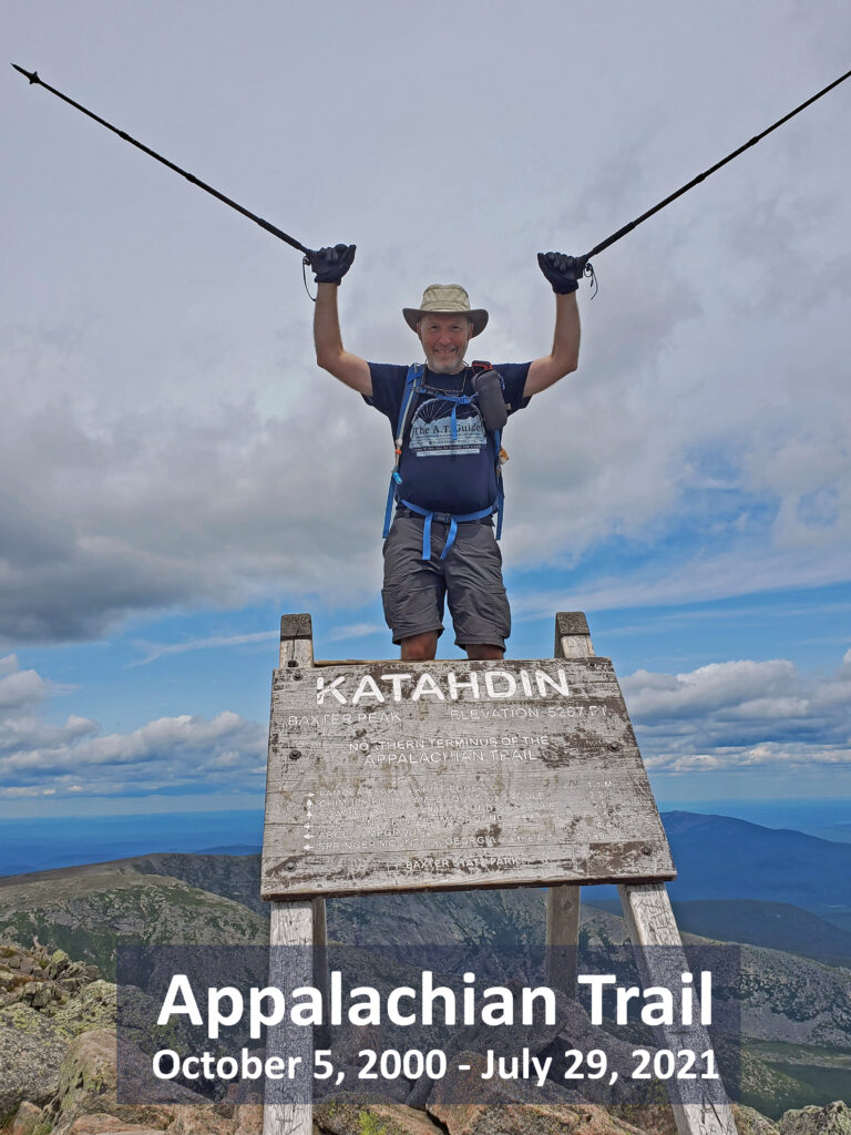
On October 5, 2000 I took my first steps on the Appalachian Trail and have continued to do section hikes since. My long held 20-year plan was to finish in 2020, but COVID19 put a change to those plans. Instead, I finished by summiting Katahdin on July 29, 2021, 20-years, 9-months, and 24-days after beginning that first hike. Since completing the trail, I do still try to get back on the trail at least a couple of times each year to hike sections. To read narratives about my hikes on the AT, visit my trail journal at http://www.trailjournals.com/trippclark.
There are lots of incredible sights along the way. To view galleries of pictures from these hikes, click the links below.